Navigation & Positioning
Understanding Ship Navigation Lanes: Essential Guide
Master the complexities of ship navigation lanes with this professional guide, covering Traffic Separation Schemes, safety best practices, and expert-level navigational s
Key takeaways
- Master the complexities of ship navigation lanes with this professional guide, covering Traffic Separation Schemes, safety best practices, and expert-level navigational s
- Understanding Ship Navigation Lanes: Key Takeaways
- What Are Ship Navigation Lanes?
- Types of Navigation Lanes
Article topic
Navigation & Positioning
Master the complexities of ship navigation lanes with this professional guide, covering Traffic Separation Schemes, safety best practices, and expert-level navigational s
Understanding Ship Navigation Lanes: Key Takeaways
- Definition: Ship navigation lanes are designated corridors established within maritime environments to facilitate orderly and safe vessel movement.
- Types: Primary lane structures include Traffic Separation Schemes (TSS), recommended transit routes, and specialized port approach channels.
- Importance: Adherence to these lanes significantly reduces collision risk, optimizes traffic flow, and ensures compliance with international maritime law.
What Are Ship Navigation Lanes?
Ship navigation lanes serve as the vital infrastructure for global maritime commerce. Much like major highway networks designed to organize vehicular traffic, these predefined corridors are implemented by maritime authorities to manage the passage of vessels through congested, narrow, or environmentally sensitive waters. By channeling traffic into predictable, unidirectional flows, maritime agencies successfully mitigate the risks of high-stakes cross-traffic collisions and groundings. For any mariner, whether commanding a commercial tanker or a private sailing vessel, an intuitive grasp of the purpose, design, and regulatory requirements of these lanes is an absolute prerequisite for safe operation. They define the ebb and flow of maritime transit in high-traffic regions across the globe, functioning as the unseen arteries of international trade. When we look at global shipping patterns, the efficiency of these lanes is paramount to maintaining the just-in-time nature of modern logistics chains. A disruption in a major lane can ripple across global markets, making the discipline of lane-keeping a cornerstone of maritime professional practice.
Types of Navigation Lanes
Traffic Separation Schemes (TSS)
A Traffic Separation Scheme represents a highly sophisticated regulatory tool, meticulously designed to isolate opposing flows of traffic. By establishing specific lanes for vessels moving in different directions—frequently separated by a neutral 'separation zone'—regulators ensure that oncoming vessels maintain a safe, predictable distance from one another. This design drastically reduces the statistical likelihood of head-on or meeting-situation collisions. In many of the world's most critical bottlenecks, such as the Dover Strait or the Singapore Strait, these schemes are mandatory for international shipping. Navigating a TSS requires a deep understanding of the specific rules detailed in the COLREGs, as these areas often have specific entry and exit requirements designed to keep the lanes flowing smoothly without creating bottlenecks at the convergence points.
Recommended Routes
Unlike the rigid mandates of a TSS, recommended routes function as suggested paths based on rigorous hydrographic surveying and historical casualty data. They steer commercial traffic away from submerged hazards, shifting sands, or protected marine sanctuaries. While not always mandatory, following a recommended route is considered best practice, as it aligns the vessel with paths already known to be safe, efficient, and well-monitored by coastal authorities. For the prudent mariner, these routes are often the path of least resistance, providing a clear track through complex archipelagos or around unpredictable coastline features that might otherwise present significant navigational risks.
Port Approach Channels
These are precision-engineered entry and exit arteries leading to major harbor facilities. Because these channels are typically restricted in width and bordered by shallow, dangerous water, the margin for error is razor-thin. Adherence to the established centerlines is mandatory to avoid grounding and to ensure that incoming, outbound, and anchored traffic remain clear of one another's transit paths. Navigation in these areas requires a heightened level of focus, as the interaction between vessel hull and shallow bottom—often referred to as 'squat' and 'bank effect'—becomes a significant factor that must be managed by the bridge team to maintain steerage and control.
Importance of Navigation Lanes
Enhancing Safety
The primary objective of any navigation lane is the proactive prevention of accidents. By fostering an environment where vessel behavior is highly predictable, these lanes allow officers on the bridge to anticipate the maneuvers of neighboring ships. This predictability is the foundation of maritime safety, creating a structured environment that prevents chaotic decision-making in high-density corridors. When every vessel follows the prescribed flow, the need for complex, reactive collision avoidance maneuvers is significantly lowered, giving bridge teams more time to evaluate data and make informed navigational choices.
Improving Efficiency
Navigation lanes organize the flow of traffic, preventing the inefficient, scattered dispersion of ships that would otherwise lead to massive logistical bottlenecks. This organized flow allows vessel operators to maintain a steady speed and optimal RPM, which significantly reduces unnecessary course alterations, optimizes fuel burn, and stabilizes transit times, which is critical for just-in-time shipping logistics. By following a structured path, vessels minimize 'encounter frequency,' allowing bridge teams to focus on maintaining a safe speed and monitoring the surrounding traffic without being interrupted by constant close-quarters situations.
Supporting Regulations
Navigation lanes serve as the physical implementation of the International Regulations for Preventing Collisions at Sea (COLREGs). They provide a tangible framework within which maritime law can be enforced. By operating within these lanes, masters ensure full compliance with the navigational protocols mandated by the International Maritime Organization (IMO), thereby protecting the crew, the cargo, and the marine environment. These regulations are not just theoretical; they are the result of centuries of maritime learning, codified to ensure that the global commons remain accessible and secure for all participants.
Navigational Aids and Their Role
Effective lane navigation relies on a robust network of aids that translate theoretical chart data into practical visual and electronic reality:
- Buoys and Marks: Lateral and cardinal marks physically delineate the safe water within a channel or the boundaries of a TSS. These markers act as the physical 'curbs' of the maritime highway.
- Lighthouses: Provide high-visibility, long-range signals that guide vessels safely during nighttime or periods of heavy fog. They remain the most reliable reference points for visual fixing.
- Radar: An indispensable tool for detecting other vessels and mapping coastline features when visual range is significantly restricted. Radar allows for the constant measurement of distance-off, a critical skill when traversing narrow approach channels.
- Lights and Shapes: Adherence to standardized light and shape protocols allows vessels to communicate their status, ensuring other mariners understand their ability to maneuver or their current operational constraints. This visual language is a vital part of the maritime safety culture, allowing for immediate identification of a vessel's state of movement or restriction.
Best Practices for Navigating Lanes
- Maintain Situational Awareness: Do not fall into the trap of relying exclusively on digital systems; maintain a constant, disciplined visual lookout to verify what the sensors are reporting. A digital screen can fail or be misleading; the horizon cannot.
- Leverage Modern Electronics: Use ECDIS and AIS integration to monitor traffic patterns in real-time, while maintaining a parallel, manual mental plot as a safety backup. Electronic tools are force multipliers, but the human navigator remains the ultimate supervisor.
- Strict Compliance: Follow all published lane rules, including entry/exit procedures and the right-of-way hierarchies established in the COLREGs. Compliance is the baseline for predictability.
- Understand Vessel Limitations: Recognize that large commercial vessels suffer from restricted maneuverability and expansive blind spots; always grant them the necessary berth. A large vessel cannot stop or turn on a dime.
- Communicate Clearly: When in doubt or when traffic density rises, utilize VHF radio to confirm passing intentions with other bridge teams early and clearly. Proactive communication avoids the need for reactive maneuvers.
Real-World Implications
Historical events highlight the volatility of maritime transit. The tragedy of the Titanic serves as a perennial, solemn lesson in the dangers of ignoring environmental cues, while the Ever Given incident in the Suez Canal underscored how a singular failure in a narrow channel can cripple global supply chains, reinforcing the critical need for absolute precision in navigation protocols. These events remind us that the sea is unforgiving and that respect for the lane and the rules is non-negotiable for anyone in command.
Conclusion
Mastering navigation lanes is more than just reading a chart; it is a fundamental commitment to the safety of all seafarers. By respecting these established routes and the aids that define them, mariners contribute to a more secure and predictable maritime domain. For those looking to sharpen their skills, consider exploring our resources on Essential Guide to Day Shapes for Mariners and Mastering Your Marine Compass. Safety at sea is a continuous process of learning, practicing, and refining one’s skills.
Frequently Asked Questions (FAQs)
What are ship navigation lanes?
They are designated, regulated corridors established to organize vessel traffic and reduce the risk of collisions in busy waterways.
Why are navigation lanes important?
They provide order, improve transit efficiency, and serve as the physical foundation for international collision avoidance regulations.
What types of navigational aids are used?
Navigation is supported by buoys, lighthouses, radar systems, and standardized light/shape signals.
How can mariners improve their navigation skills?
Continuous practice with both electronic and manual techniques, adherence to COLREGs, and proactive communication are key factors for improvement.
Final Summary
Navigation lanes remain a fundamental component of safe maritime transit. Balancing the requirements of traffic efficiency with the need for individual vessel safety requires constant vigilance, technical competence, and strict adherence to established rules. By prioritizing professional seamanship over convenience, operators can ensure that every voyage remains safe, predictable, and compliant with international standards. Always consult your charts, understand your local authority requirements, and prioritize clear communication in high-traffic corridors. The path to safety is well-marked; it is up to the mariner to follow it.
Practical Skipper Examples
Navigating the English Channel requires more than just following lines on a chart; it requires an active mental model of vessel behavior. Consider a captain of a 40-meter yacht crossing the Dover Strait. As they approach the Traffic Separation Scheme (TSS), the primary practical rule is to cross at a right angle. By doing so, the vessel minimizes the 'time in the lane,' reducing the window of exposure to high-speed commercial traffic. A skipper failing to maintain a 90-degree heading increases the duration of their transit, effectively placing their vessel in the path of a bulk carrier for an unnecessary length of time.
In high-traffic regions like the Singapore Strait, the 'pre-emptive communication' technique is vital. A skipper should identify major commercial vessels on AIS long before they enter the narrow channel. By calling the vessel on VHF channel 16 or the local working frequency, the skipper can clarify intentions. For instance, if a container ship is overtaking, the skipper of the smaller vessel should inform the bridge crew of their intent to hold a steady course or alter to starboard. This eliminates the 'guesswork' that often leads to near-misses.
When navigating port approach channels, such as the entrance to Rotterdam or Long Beach, the skipper must account for 'bank effect.' As a vessel moves through a constrained channel, the water pressure differential between the hull and the bank can pull the stern toward the edge. A practical skipper knows to stay centrally located within the dredged depth. If they are forced to veer, they must apply increased rudder angle early to counteract the suction effect, a nuance often missed by weekend sailors who treat navigation lanes as simple lanes on a highway.
Furthermore, weather-driven lane changes are a common skipper reality. If a heavy swell is running against the tide in a channel, the resulting 'steep sea state' can make the vessel difficult to steer. A savvy skipper will adjust their speed to maintain maneuverability rather than trying to adhere to a strict ETA. They prioritize keeping the vessel’s head to the sea, even if it means tacking slightly within the allowed width of the lane, rather than fighting the helm and losing directional control. These real-world adjustments transform a theoretical knowledge of lanes into active, professional-grade seamanship.
Detailed Checklist for Safe Use
A structured approach to navigation lanes minimizes fatigue and cognitive overload. Use the following checklist to ensure compliance and safety throughout your journey.
Planning Phase (Before Getting Underway)
- Chart Review: Identify all TSS zones, prohibited areas, and deep-water routes on your current Electronic Navigational Charts (ENCs).
- Tide and Current Analysis: Calculate the set and drift. Determine how the current will push the vessel relative to the lane boundaries.
- Communication Plan: Verify that VHF radio equipment is operational and check the port authority’s specific reporting requirements for the lane.
- Contingency Routes: Identify at least two 'exit points' where you can safely leave the channel if an emergency or severe weather arises.
Underway Phase (While in the Lane)
- The 5-Minute Rule: Every five minutes, perform a visual scan of the horizon combined with an AIS review. Do not rely solely on screens.
- Speed Management: Ensure the vessel speed matches the 'flow' of the lane traffic. Avoid being the slowest vessel in a high-speed corridor.
- Position Verification: Use at least two independent sources for positioning (e.g., GPS/GNSS and visual bearings or radar distance-off).
- Bridge Resource Management: Assign a dedicated lookout if traffic density is moderate to high. Rotate positions if the transit takes longer than two hours.
Post-Use Phase (Exiting the Lane)
- Traffic Clearance: Confirm through visual and radar observation that the surrounding water is clear before making a significant course change out of the lane.
- Log Entry: Record the time of entry and exit, as well as any unusual traffic patterns or environmental conditions encountered.
- Equipment Reset: Reset radar parameters for open-ocean settings, such as longer pulse lengths, and return AIS to a wider range if the transit is complete.
- Post-Voyage Critique: Spend five minutes debriefing with the crew. Discuss what went well and what communication gaps occurred during the transit.
Troubleshooting and Common Mistakes
Mistakes in navigation lanes often stem from complacency. The most common error is 'chart fixation,' where the skipper trusts the digital display over the physical reality of the water. If the AIS shows a clear path but the radar indicates a target, the radar must always take precedence. A common failure is neglecting the 'shadow zone' created by larger ships; small vessels can be hidden behind the superstructure of a massive freighter. If you cannot see their bridge, they likely cannot see you.
Another frequent error is the misinterpretation of navigation light configurations. A skipper might see a series of lights and assume it is a fixed navigational aid, when in fact it is a vessel restricted in its ability to maneuver (RAM). If you find yourself unsure of a vessel’s status, the correction is immediate: assume they are a danger, increase your distance, and alter course early. Hesitation is the enemy of safety in crowded corridors.
Signal failure is a major risk. If your AIS unit malfunctions while in a lane, your vessel becomes a 'stealth' object to commercial traffic. The corrective step is to immediately increase visual vigilance, use radar reflector panels to enhance your signature, and attempt to contact nearby large vessels to inform them of your lack of electronic visibility. If the equipment cannot be repaired, exiting the main lane for a safer, lower-traffic secondary route is the most prudent decision. Never rely on a single piece of hardware when navigating in high-stakes environments.
Final Safety Summary
Navigation lanes are the highways of the sea, yet they lack the physical barriers and lane markers of terrestrial roads. Their safety is entirely dependent on the shared situational awareness of all participants. A professional approach to lane navigation is characterized by constant anticipation; you should always be thinking about where your vessel will be in ten minutes, not where it is right now. To move forward, every skipper should invest in training beyond the basic license. Deepen your understanding of the International Regulations for Preventing Collisions at Sea (COLREGs), specifically the rules governing narrow channels. Practice radar plotting until it becomes second nature, and regularly participate in bridge simulation exercises if available. The ultimate safety goal is to be predictable to other mariners. By maintaining a steady course, communicating intentions early, and adhering to established navigational protocols, you contribute to a culture of safety that protects everyone on the water. Stay vigilant, keep your equipment updated, and always prioritize the preservation of life and vessel over a shorter arrival time.
Advanced Onboard Scenarios
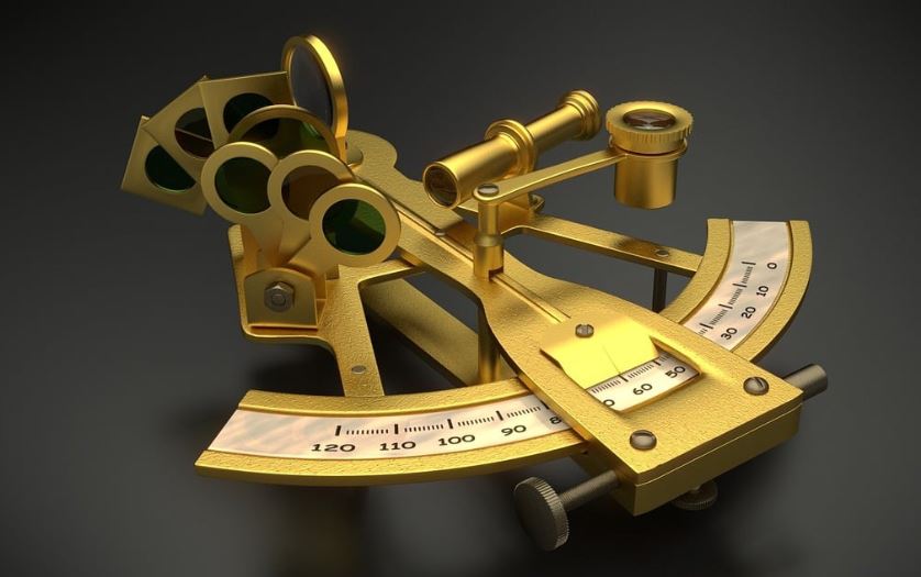
Navigating high-density traffic lanes requires more than just following the plotted line; it demands tactical foresight. Consider the scenario of a vessel experiencing 'interaction effects' when overtaking a larger ship within a narrow Traffic Separation Scheme (TSS). As your vessel draws parallel, the Bernoulli principle causes a pressure differential, potentially pulling your bow toward the larger ship. An advanced skipper must anticipate this 'bank or ship suction' by increasing the rudder angle away from the larger vessel well before the proximity threshold is reached. Another complex situation involves navigating lanes during 'whiteout' or severe sea clutter conditions on radar. When Electronic Chart Display and Information Systems (ECDIS) may become saturated with AIS targets, the primary navigation tool shifts to manual plotting and acoustic awareness. In such instances, maintain a 'silent bridge' protocol where non-essential communication ceases. Focus specifically on isolating the closest point of approach (CPA) for vessels that are not transmitting AIS signals—often small fishing vessels or unpowered craft that present a silent, high-consequence risk. Dynamic environmental shifts, such as sudden fog banks obscuring coastal marks, necessitate an immediate transition to 'blind pilotage.' This involves a pre-calculated series of parallel indexing maneuvers. By selecting a known charted feature at a safe distance from your track, you use the radar's variable range marker to maintain a constant cross-track distance. If the radar target of the landmark moves off your preset index line, you adjust your heading immediately to compensate for set and drift, rather than waiting for a GPS position fix which may have a slight latency. Finally, consider the scenario of navigating lanes during a localized 'GPS spoofing' event or signal interference. Modern bridge management requires the ability to cross-reference digital positions with terrestrial visual bearings and dead reckoning. If your ECDIS position jumps or displays a warning, the advanced skipper executes an immediate 'emergency manual fix' using sextant angles between charted lighthouses or radar ranges to multiple points of land. Relying solely on the screen in a high-density lane during a GPS anomaly is a critical error. Mastering the transition between automated precision and manual situational awareness is what separates a novice navigator from a seasoned professional in today’s complex shipping environment.
Extra Safety Decision Points
Safe navigation is fundamentally a series of calculated decisions. When operating within a navigation lane, a skipper should utilize specific 'trigger points' to initiate a safety escalation. These are not merely suggestions but defined moments where the risk-to-reward ratio shifts. The first decision point is the 'Traffic Density Threshold.' If your radar indicates more than three vessels within a five-mile radius that require constant course adjustments, you must escalate to 'Heavy Traffic Procedures.' This includes bringing an extra lookout to the bridge and ensuring the engine is in a state of immediate readiness for maneuver, even if you are currently in an open-water lane section. The second decision point involves 'Meteorological Escalation.' If visibility drops below two miles or winds exceed force 6 while in a congested lane, the skipper should decide to either slow the vessel to 'steerage way' or divert to a secondary, lower-traffic route. Never attempt to maintain speed in a lane when environmental conditions limit your ability to distinguish the lights or shapes of vessels in your immediate vicinity. The third point concerns 'Communication Failure.' If you attempt to contact a vessel on VHF and receive no response, assume they are unaware of your presence. Do not wait for a second attempt; initiate an evasive maneuver immediately. The silence of the other vessel is a formal escalation signal that your collision-avoidance strategy must now be entirely unilateral.
Skipper’s Decision Escalation Checklist
- Density Alert: Does the number of targets exceed current bridge capacity to monitor? If yes, activate bridge support.
- Visibility Floor: Has visibility dropped below your minimum safe threshold? If yes, sound fog signals and reduce speed to bare steerage.
- Course Conflict: Is the CPA less than 0.5 nautical miles? If yes, change course decisively and early to show clear intent.
- Equipment Health: Is there a discrepancy between GPS and Radar? If yes, revert to terrestrial navigation methods immediately.
- Fatigue Check: Have the watch standers been on duty for more than four hours? If yes, rotate personnel to maintain high alertness.
- System Integrity: Has the AIS or Radar signal become intermittent? If yes, increase visual lookout frequency and maintain a wider berth from all traffic.
By formalizing these decision points, skippers remove the ambiguity of 'gut feelings' and replace them with objective, measurable safety criteria that protect the crew, the cargo, and the vessel. This comprehensive approach ensures that every transit through a lane is conducted with the highest professional standards, minimizing risk to life and property at sea. Internal resources for continued learning include: Navigating Without GPS: Essential Techniques for Mariners and Essential Safety Equipment Checks for Maritime Professionals.
Frequently asked questions
Ship navigation lanes are designated paths in the water where vessels navigate to ensure safety and efficiency, minimizing collision risks.
Comments coming soon
We’re preparing a community discussion area for every learning article.
Related articles
Read More
Continue with related sailing guides and topic pages to build a stronger understanding before your next passage.
AI route planning mistakes sailors should avoid
7 AI Route Planning Mistakes Sailors Must Avoid in Modern Navigation
Discover the critical pitfalls of relying solely on AI for nautical route planning. Learn how to balance technology with traditional seamanship for safer voyages.
Read MoreNavigation & Positioning
Autopilot Systems for Yachts: Essential Guide for Sailors
Explore the key features and benefits of yacht autopilot systems. Enhance safety and comfort on your voyages with this comprehensive guide.
Read Morecoastal-navigation
Basic Coastal Navigation for New Sailors
A beginner-friendly coastal navigation guide covering charts, position checks, bearings, waypoints, hazards, and pilotage planning.
Read MoreNavigation & Positioning
Explore more in Navigation & Positioning
Charts, bearings, GPS, coordinates, passage awareness, and position checks.
Read MoreLearning Center
Browse the Learning Center
Find navigation, weather, seamanship, safety, and marina planning articles.
Read More